

First responders gets DiaBolically clever support
Nokia has created a flying branch of the emergency services, comprising 70 airborne devices that can be guided along the 5G network of Belgian telecom operator Citymesh. The Nokia Drone Networks system comes in unit sizes of 70 Drone-in-a-Box (DiaBs) with the aim of achieving instant aerial data collection of the critical first minutes needed to create a more informed response by emergency services. The Belgian services receive over 2 million calls per year and the new devices add a new dimension, since they come equipped with video and thermal cameras. The drones can respond quicker as they are on constant stand-by (24/7) and can be managed, remotely, from five centralised operations centres.
With their high definition and AI-enhanced thermal imaging, drones capture live aerial footage of smoke plumes, fire parameters and the numbers and positions of people on the scene. Then beams this back to the control centres even before emergency teams have had time to leave. This means emergency responders no longer have to fly into the scenes of unfolding disasters ‘blind’ but these new pre-emptive intelligence could save lives. These aerial images are essential to identifying a plan of action that can save lives and limit damage to affected assets and natural resources.
Equipped with high definition and AI-enhanced thermal imaging, drones capture real-time aerial footage – such as smoke plumes, fire parameters, and number/location of people – and transfer it to control centres even before emergency teams have had time to leave. These aerial images are essential to identifying a plan of action that can save lives and limit damage to affected assets and natural resources.
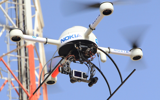
The Nokia system is equipped with a dual gimbal camera, docking station, edge data processing, and it is supported by an open API framework that allows integration of third-party applications to expand its capabilities for a wider range of use-cases. Using Nokia MX Industrial Edge (MXIE) it ensures that collected data is stored locally and stays under the full control of authorities “Our 5G-connected drone platform is a logical extension of building nationwide wireless networks,” said Thomas Eder, Nokia ‘s Head of Embedded Wireless Solutions, “it’s game-changer for operational efficiency of first responders and data security.
The nationwide availability of SENSE follows pilot projects in the Fluvia fire brigade in Kortrijk, Brussels Airport Company, Port of Antwerp-Bruges and the city of Genk with the support of the Federal Public Service Economy. “SENSE is a great example of how technology can save lives, said Hans Similon, General Manager, Citymesh Safety Drone, “Together, we’re making Belgium safer and proving just how innovative we are as a nation.”
The new nationwide availability of SENSE follows pilot projects in the Fluvia fire brigade in Kortrijk, Brussels Airport Company, Port of Antwerp-Bruges, and the city of Genk, with the support of the Federal Public Service Economy.
The Nokia Drone Networks systems connects to public and private 4G and 5G networks to enhance situational awareness for first responders and other professionals. It can be operated remotely and complies with the aviation regulatory bodies such as EASA in Europe and FAA in the United States.