

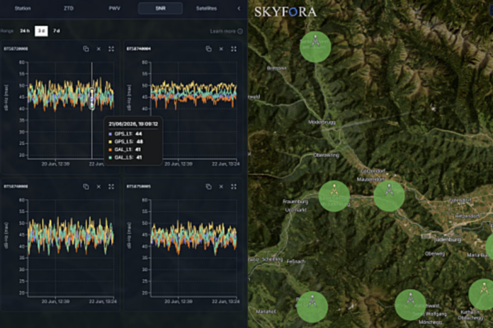
Cell sites act as sensors to detect interference with satellite-based positioning and timing signals to protect situational awareness, critical infra, authorities and public safety services
Austria’s A1 Group is evolving its mobile network into a data platform that can detect interference with global navigation satellite systems (GNSS), colloquially referred to as GPS. GNSS interference is becoming increasingly prevalent and could affect transport, aviation, defence, logistics and public safety.
At an aviation conference in June on this subject, Nick Careen, International Air Transport Association (IATA) Senior Vice President, Operations, Safety and Security, stated, “The number of global positioning system (GPS) signal loss events increased by 220% between 2021 and 2024 according to IATA’s data from the Global Aviation Data Management Flight Data eXchange (GADM FDX). With continued geopolitical tensions, it is difficult to see this trend reversing in the near term.”
Engineers Ireland says on its website, “GPS interference has moved out of the conflict zone and into routine European operations. For surveyors, drone pilots and machine-control crews, positioning that quietly degrades or misleads is now a live risk, and resilience is becoming part of the job.”

A1 in action
Against this backdrop, in collaboration with Skyfora and Nokia, A1 is testing this detection capability at selected mobile network sites in Austria and Slovenia. The solution builds on the same technological foundation that A1 recently introduced to generate weather data. In both cases, GNSS signals received at mobile network sites are analysed to derive additional insights — from atmospheric conditions to signal anomalies.
Satellite-based positioning and timing systems such as GPS, Galileo, GLONASS and BeiDou are essential for navigation, logistics, aviation and telecommunications, as well as for the precise timing that underpins modern digital infrastructure.
Interference – including jamming and spoofing – can disrupt operations across multiple sectors. Jamming is deliberately blocking or overwhelming of satellite signals; spoofing involves transmitting false signals that can mislead positioning or timing systems.
By analysing GNSS’ signal behaviour at fixed network sites and correlating data across locations, A1 can help detect anomalies and identify affected areas in near real-time, generating the basis for high precision geolocation services.
Fredrik Borgström, CEO of Skyfora, said, “Mobile networks are uniquely positioned to strengthen national resilience. Building on Skyfora’s expertise in GNSS-based atmospheric observations from telecom infrastructure, we are proud to support A1 in turning its network into a ground-based sensing layer for GNSS interference detection in Austria.”
Christian Laqué, CTO of A1 Austria, commented, “We are continuously evolving our network and unlocking capabilities beyond connectivity…What matters is that this information is created exactly where it is needed – with high geographical resolution and without requiring additional infrastructure.”
“This initiative demonstrates how existing mobile network technology can go beyond connectivity, providing valuable data-driven insights that enhance resilience and prepare for AI workloads with new applications. We are proud to [bring] new value,” added Christoph Rohr, Country Manager at Nokia.

